
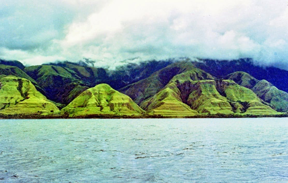
Photo: Assistant District Commissioner Bob Hoad, 1972.
By Rod Benson
New Guinea is the world’s second largest island, after Greenland. The human history of New Guinea extends far beyond the appearance of the Lapita cultural complex about 3,300 years ago. Archaeological, environmental and genetic evidence indicates that people had already lived in the region for tens of thousands of years, adapting to environments ranging from tropical coastlines and dense rainforests to mountain valleys more than 2,000 metres above sea level.
Although many questions remain unresolved, the evidence portrays the earliest inhabitants not as marginal wanderers awaiting later cultural development, but as capable maritime colonists, knowledgeable users and managers of tropical environments, and participants in increasingly extensive networks of mobility and exchange.
The term “settlement” nevertheless requires care. For the earliest periods, archaeology rarely identifies permanent villages or territorially fixed communities. It more often reveals episodes of occupation, repeated visits, seasonal movement and sustained use of particular landscapes. The history of settlement therefore encompasses several related processes: first arrival, dispersal across different environments, repeated occupation, demographic growth and, eventually, the development of more permanent communities. These processes did not necessarily occur at the same time or in the same manner throughout New Guinea.
New Guinea within ancient Sahul
The earliest settlement of New Guinea must be understood within the geography of the late Pleistocene. During periods of lower sea level, New Guinea, Australia and Tasmania formed a single continent known as Sahul. The Arafura Sea and Torres Strait were then broad plains connecting southern New Guinea with northern Australia, while Tasmania was connected to the Australian mainland during the coldest phases. The first people did not therefore arrive on an island resembling modern New Guinea. They entered a much larger landmass whose northern mountains and tropical forests formed part of a continent extending southwards to Tasmania.
Sahul was nevertheless separated from Southeast Asia by the deep-water channels of Wallacea. Even at the lowest sea levels, no continuous land bridge connected the Sunda shelf—encompassing mainland Southeast Asia, Sumatra, Java and Borneo—with Sahul. The first arrivals therefore undertook several sea crossings, probably moving through the islands of eastern Indonesia. Their passage required some capacity to construct watercraft, read currents and weather, coordinate group movement and carry essential resources. The peopling of Sahul was consequently one of the earliest major episodes of maritime expansion in human history.
Successful colonisation probably required more than a few people carried accidentally across the sea. Modelling of the possible migration routes suggests that deliberate voyaging by socially viable groups provides a more persuasive explanation. Such movements may have included women, men and children, together with tools, food, water and fire-making resources. The exact form of their vessels and social organisation remains unknown, but repeated crossings of marine barriers point to purposeful movement, collective decision-making and knowledge transmitted across generations.
When did people arrive?
The date of the first arrival remains debated. Excavations at Madjedbebe in northern Australia have produced a proposed occupation date of approximately 65,000 years ago. This chronology is based principally on optically stimulated luminescence dating and is supported by a substantial artefact assemblage. Debate continues, however, over the depositional history of the site, the possibility of vertical movement among some artefacts and the precision of the earliest chronology. A more conservative conclusion—that people were present in northern Australia by at least 50,000 years ago—is widely accepted.
Evidence from Madjedbebe concerns the settlement of Sahul as a whole, not New Guinea specifically. It demonstrates that people had reached some part of the continent but cannot establish when they first occupied its northern region. The earliest securely dated archaeological evidence presently known from New Guinea begins at approximately 49,000 years ago. It remains possible that people entered New Guinea earlier, especially if Sahul had been occupied for 60,000 years or more, but no excavated New Guinea site has yet established substantially earlier occupation beyond reasonable dispute.
This distinction illustrates a broader methodological principle. Archaeology identifies the earliest surviving evidence discovered so far, not necessarily the actual first human presence. The oldest known site may be thousands of years younger than the first arrival. Preservation, geological disturbance, limited excavation and the submergence of ancient coastlines all constrain what can be recovered. Assertions concerning the first settlement must therefore distinguish secure archaeological dates from plausible inferences based on the wider history of Sahul.
Routes into New Guinea
The route or routes by which people reached Sahul are also uncertain. One proposed northern pathway passed through Sulawesi and the northern Moluccas towards the Bird’s Head region of western New Guinea. A southern pathway may have passed through the Lesser Sunda Islands, including Flores and Timor, towards the exposed northwestern shelf of Sahul. Archaeological evidence and geographical modelling have not established that one route was used exclusively. Different groups may have arrived through different island chains or at different times.
Western New Guinea is potentially crucial to understanding these movements. Archaeological work has been undertaken in the Bird’s Head, coastal regions and highlands, but investigation directed specifically towards the earliest settlement question remains uneven. Political boundaries, difficult terrain, research access, preservation and the colonial and postcolonial history of scholarship have shaped where archaeologists have worked and published. The present concentration of early securely dated sites in Papua New Guinea does not necessarily mean that settlement began in the eastern half of the island.
The Ivane Valley: life in the highlands
The strongest early evidence comes from the Ivane Valley near Kosipe in the central highlands of Papua New Guinea. Excavations have revealed human activity dating from approximately 49,000 to 44,000 years ago at an elevation of about 2,000 metres. This discovery demonstrates that early populations did not remain confined to tropical coastlines or lowland rivers. Relatively soon after Sahul was colonised, people were exploring and using cool montane environments markedly different from those encountered along migration routes through equatorial Southeast Asia.
The Ivane Valley assemblages include flaked and waisted stone implements, plant residues and stone transported from sources beyond the immediate locality. Evidence points to the exploitation of pandanus nuts and yam-like plants. Some tools may have been employed to clear vegetation or work wood. Researchers have suggested that people opened forest patches and possibly encouraged the growth of useful plants, although this remains an interpretation rather than a directly demonstrated purpose. The evidence does not establish agriculture in the later sense, but it does reveal systematic plant use and some degree of environmental intervention.
The technological evidence should be described carefully. Waisted tools are sometimes called axes, but not all were necessarily fully ground or used for identical purposes. The assemblages nevertheless include early ground-edge technology. The production, maintenance and transport of stone implements demonstrate technical planning and learned traditions. Plant residues and wear traces also indicate knowledge of the location, seasonality and processing requirements of highland foods. Such knowledge had to be accumulated and transmitted across generations.
The Ivane discoveries overturn older assumptions that the New Guinea highlands were settled only after agriculture made permanent occupation possible. Early inhabitants evidently possessed the shelter, fire-making practices, technical knowledge and social organisation required to live in a relatively cold upland environment. Occupation and plant exploitation are documented from approximately 49,000 years ago onward, including the securely dated earliest phase between about 49,000 and 44,000 years ago. The valley therefore records not merely human presence but rapid cultural adaptation to a demanding environment.
Vanished coastlines and incomplete evidence
Direct evidence from New Guinea’s earliest coastlines remains scarce. This does not imply that coastal settlement was unimportant. During the late Pleistocene, coastlines lay far beyond their present positions. Post-glacial sea-level rise progressively inundated the Arafura shelf, and the final land connection across Torres Strait disappeared about 8,000 years ago. This transformed the northern region of Sahul into the separate island of New Guinea.
Many of the places most likely to preserve evidence of first arrival, fishing, shellfish collection and coastal encampment now lie beneath the sea. Tropical soils also accelerate the destruction of bone, wood, fibre and other organic materials. Archaeology consequently preserves a selective record weighted towards caves, rockshelters, durable stone artefacts and environments in which sediments accumulated without severe disturbance. The apparent scarcity of early coastal evidence is therefore partly a consequence of geological change and preservation.
Bobongara, on the Huon Peninsula, has sometimes been presented as evidence for human occupation around 40,000 years ago or earlier. Stone artefacts were recovered from deposits dated by thermoluminescence, but questions remain about the relationship between the objects and the dated sediments. Bobongara remains potentially important, yet its chronology is less secure than that of the Ivane Valley. A responsible reconstruction must distinguish between securely dated occupation, probable evidence and unresolved archaeological claims.
New Britain and New Ireland
Evidence from islands adjacent to New Guinea enlarges the picture. New Britain and New Ireland remained separated from mainland New Guinea even when sea levels were substantially lower. Their settlement therefore required further maritime crossings.
At Buang Merabak Cave in New Ireland, human occupation is now generally placed at approximately 42,000 years ago. Earlier publications reported radiocarbon determinations beyond 40,000 uncalibrated years before the present, and subsequent discussion has placed the earliest occupation within a broadly similar calibrated range. The cave contains stone artefacts and faunal remains documenting a long history of island resource use.
Other important sites include Matenkupkum in New Ireland and Yombon in New Britain. Matenkupkum preserves intermittent occupation extending back to approximately 35,000 years ago, while occupation at Yombon is generally assigned to a similar broad period. The precise chronology and integrity of particular deposits continue to be assessed, but together these sites demonstrate sustained late-Pleistocene settlement within the Bismarck Archipelago.
The communities represented at these sites lived many millennia before Lapita pottery appeared. They should not be described simply as Lapita people or automatically identified as the direct cultural ancestors of later Lapita communities. They belonged to much older populations that developed their own technologies, subsistence strategies and social networks. Their occupation of islands separated by open water demonstrates that maritime competence remained integral to regional life after the initial crossing into Sahul.
Buka and Manus
By approximately 29,000–30,000 years ago, people had reached Kilu Cave on Buka Island, at the northern end of the Solomon Islands chain. Buka was not joined to New Guinea or New Britain, and reaching it required a significant open-water crossing. Kilu Cave has yielded flaked stone artefacts, worked shell, animal remains and evidence for plant processing.
Its inhabitants exploited reef resources and caught some pelagic fish. This indicates knowledge of varied marine habitats, although the surviving remains do not justify depicting the site as the centre of a large-scale offshore fishery. Kilu nevertheless provides compelling evidence that people had extended beyond the Bismarcks and into the northern Solomon Islands thousands of years before the end of the Pleistocene.
People had reached remote Manus by approximately 13,000–12,000 years ago, as indicated by the earliest secure evidence from Pamwak Rockshelter. Manus lies more than 200 kilometres from mainland New Guinea, and reaching it required substantial open-water voyaging. Its occupation marks a further stage in the expansion of human communities across Near Oceania.
Mobility did not end once islands had been colonised. Obsidian from chemically distinctive volcanic sources was transported across water, sometimes over hundreds of kilometres. Animals were also carried beyond their natural ranges, although particular translocations occurred at different times and should not all be assigned to the earliest settlement period. These movements reveal planned voyaging, exchange relationships and shared geographical knowledge long before the emergence of the later Lapita exchange network.
Changing environments and human influence
The landscapes encountered by the earliest inhabitants were not static. Climate fluctuations altered rainfall, temperature, vegetation and the distribution of animals. During colder and drier phases, grasslands extended into some areas later covered by rainforest. Rivers changed course, volcanic eruptions transformed local environments, and rising seas created new coastlines, islands and marine ecosystems.
People also modified these landscapes. Burning, vegetation clearance, plant selection and the movement of useful species probably produced cumulative ecological effects. The Ivane Valley evidence suggests deliberate disturbance of forest vegetation, while later sites document increasingly intensive landscape management. Yet changes in vegetation, fire frequency or animal populations cannot automatically be attributed to human action. Climatic variation, volcanic activity and natural ecological processes must also be considered. In many cases the evidence does not permit a simple separation of human and environmental causes.
Population history and Denisovan ancestry
Genetic research broadly supports the great antiquity of settlement. Many present-day Papuan populations possess deeply rooted genetic lineages and among the highest proportions of Denisovan ancestry found in living people. This ancestry resulted from interbreeding between modern humans and one or more Denisovan-related populations somewhere in Asia before or during the migration towards Sahul.
Genetics cannot identify the precise location or date of these encounters. Nor does Denisovan ancestry prove that Denisovans lived in New Guinea, since no Denisovan fossil remains have been found there. Some genetic research suggests that the ancestors of Papuan peoples received ancestry from more than one Denisovan-related population. Genetic evidence therefore preserves traces of complex encounters during the wider movement of modern humans through Asia, but it cannot be mapped directly onto a particular archaeological site or culture.
Genomic studies also reveal substantial regional differentiation among New Guinea populations, including long periods of relative separation among various highland and lowland communities, followed by complex episodes of contact and admixture. It would be misleading to imagine one homogeneous highland population opposed to one homogeneous lowland population. Present-day Papuan peoples retain substantial ancestry from early inhabitants of Sahul, but no modern community can simply be equated with a single Pleistocene population. Tens of thousands of years of movement, isolation, demographic change and intermarriage separate the earliest archaeological communities from the peoples of the present.
Language and deep history
New Guinea contains more languages than any comparable region of the world, with more than 800 languages spoken across the island, depending on classification and contemporary language vitality. Many belong to the Austronesian family, while hundreds of others are conventionally described as Papuan.
“Papuan,” however, does not name one people or one language family. It is a collective designation for numerous non-Austronesian language families and isolates. These languages cannot be assumed to descend from one original “Papuan language,” nor can their present distribution be treated as a simple map of the first settlement.
The island’s linguistic diversity is consistent with long-term regional differentiation in geographically complex terrain, but linguistic evidence cannot be projected securely back 40,000 or 50,000 years. Languages change too extensively for conventional historical linguistics to reconstruct relationships across such immense periods. Linguistic diversity supports a history of deep differentiation without allowing particular modern languages to be identified as those spoken by the earliest inhabitants.
From plant management to agriculture
The earliest inhabitants lived by hunting, gathering, fishing and plant processing, but these categories can obscure the sophistication of their ecological knowledge. Evidence from the Ivane Valley demonstrates systematic use of pandanus and underground plant foods almost 50,000 years ago. Over subsequent millennia, communities manipulated vegetation, transferred useful species and reshaped local environments.
At Kuk Swamp in the Wahgi Valley, plant exploitation and possible cultivation occurred on the wetland margin between approximately 10,220 and 9,910 calibrated years before the present. More definite evidence of cultivation appears in later phases. Mounded cultivation and intensive banana cultivation date to approximately 6,950–6,440 years ago, while formal ditched cultivation appeared later, around 4,350–3,980 years ago. Taro was used during the early Holocene, although the status of particular plants as managed, cultivated or fully domesticated must be assessed separately.
The Kuk sequence does not represent a sudden agricultural revolution. Plant management, cultivation and domestication are related but distinct processes. Communities may cultivate plants without producing marked genetic domestication, while hunting, fishing and gathering often continue alongside horticulture. Different New Guinean societies adopted, intensified or declined cultivation at different times. Agriculture was not a uniform stage through which the entire island passed simultaneously.
Tropical plant foods leave a less conspicuous archaeological record than cereal grains. Bananas, taro, yams and sugar cane rarely survive as readily identifiable macroscopic remains. Researchers must instead analyse phytoliths, starch residues, pollen, drainage features, digging implements and microscopic wear on stone tools. The resulting record is remarkable but remains open to revision as analytical techniques improve.
New Guinea’s agricultural systems developed without the cereal crops, plough agriculture and large domesticated livestock characteristic of parts of Eurasia. Pigs were incorporated into New Guinean subsistence systems before European contact, but their arrival and spread postdated the earliest cultivation at Kuk. New Guinean communities created distinctive forms of horticulture centred on root crops, bananas, tree crops and intensive management of wetlands, forest margins and fallow vegetation. These systems represent an important history of indigenous agricultural innovation.
Lapita as a late development
Lapita culture appeared in the Bismarck Archipelago about 3,300 years ago. It is identified archaeologically through dentate-stamped pottery, particular settlement forms, introduced plants and animals, and extensive maritime exchange. Lapita communities played a major role in the expansion of Oceanic languages, a branch of the wider Austronesian language family, and in the settlement of Remote Oceania.
Lapita nevertheless represents a late chapter in New Guinea’s human history. When Lapita communities entered the Bismarcks and parts of the New Guinea coast, they encountered regions whose peoples possessed tens of thousands of years of local experience. Subsequent history involved exchange, intermarriage, cultural transformation, coexistence and probably some episodes of displacement. The relative importance of these processes varied from place to place. Lapita should not be treated as the beginning of civilisation in the region or as the sole ancestral source of contemporary Melanesian peoples.
Whose history is being reconstructed?
Archaeological and genetic accounts are not the only ways in which New Guinea’s past is known. Indigenous communities possess origin traditions, genealogies, ritual geographies and detailed knowledge of ancestral relationships with land and sea. These traditions should not automatically be interpreted as literal memories of events 40,000 years ago, nor can they simply be converted into archaeological dates. They nevertheless constitute significant forms of historical knowledge and should not be displaced by an assumption that scientific reconstruction is the only meaningful account of antiquity.
Research has also been shaped by colonial history. European, Australian and other overseas institutions conducted much early archaeological and anthropological work, often within frameworks that gave limited authority to local communities. Many collections and research records came to be held in overseas institutions. Political borders and unequal access to funding have also contributed to the uneven investigation of eastern and western New Guinea.
Contemporary research increasingly depends on cooperation with customary landowners, local scholars, community organisations and Papua New Guinean and Indonesian institutions. Archaeological sites are not merely scientific deposits. They may be ancestral places embedded in continuing relationships of ownership, responsibility and sacred significance. A responsible history should recognise both the contribution of scientific methods and the authority of the communities whose lands contain the evidence.
What the evidence can—and cannot—tell us
The evidence for early settlement is not uniform. The Ivane Valley provides securely dated archaeological occupation. Sites including Buang Merabak, Matenkupkum, Yombon, Kilu Cave and Pamwak document later stages of settlement and maritime expansion, although their chronologies vary in precision. Bobongara offers plausible but disputed evidence. Genetics provides evidence of ancient population history and admixture, while palaeoenvironmental records reveal the changing landscapes within which people lived. Each form of evidence answers different questions and carries different limitations.
Several conclusions can nevertheless be stated with confidence. Humans reached Sahul at least 50,000 years ago and possibly considerably earlier. They necessarily possessed maritime capabilities because Sahul could never be reached entirely by land. Secure evidence places people in the New Guinea highlands by approximately 49,000 years ago and in New Ireland by about 42,000 years ago. By approximately 30,000 years ago they had reached the northern Solomon Islands, and by about 13,000–12,000 years ago they had occupied remote Manus.
Across this long period, populations adapted to coasts, rainforests, mountains and small islands. They processed diverse plant foods, manufactured specialised tools, disturbed and managed vegetation, crossed open sea and maintained networks through which stone, animals and knowledge circulated. These developments did not occur simultaneously at every site, but together they reveal sustained innovation across Near Oceania. Much later, some New Guinean communities developed agricultural systems of considerable complexity.
Important matters remain unknown. Archaeology has not identified the first landing place, the precise migration route, the number of founding movements or the exact date at which people entered the New Guinea region. Early coastal sites may lie beneath the sea, while tropical conditions have destroyed much organic evidence. Claims for occupation substantially before 50,000 years ago in New Guinea remain plausible within the wider chronology of Sahul but have not yet been demonstrated by a secure local archaeological sequence.
Conclusion
The earliest history of New Guinea cannot be reduced to a single migration, culture or technological transition. It is a history of maritime arrival, ecological exploration, regional differentiation and cumulative innovation across one of the world’s most environmentally complex regions. The first inhabitants did more than survive unfamiliar conditions. Through technical knowledge, social cooperation and careful observation, they created viable human worlds within mountains, forests, rivers, coasts and islands.
Long before Lapita pottery, Austronesian languages or European contact, New Guinea had sustained tens of thousands of years of human creativity. Its early inhabitants were among the world’s pioneering maritime colonists and highland settlers. Some communities also became increasingly active managers of tropical landscapes, eventually contributing to distinctive indigenous systems of cultivation.
The archaeological record remains incomplete, but what survives is sufficient to establish New Guinea as one of the great centres of deep human history.
Rev Dr Rod Benson is General Secretary of the NSW Ecumenical Council and a minister of the Uniting Church in Australia serving at North Rocks Community Church in Sydney.
Image source: Papua New Guinea Kiaps Facebook Group

